
Map Tools
The map tools feature is located in the upper left-hand corner of the map.
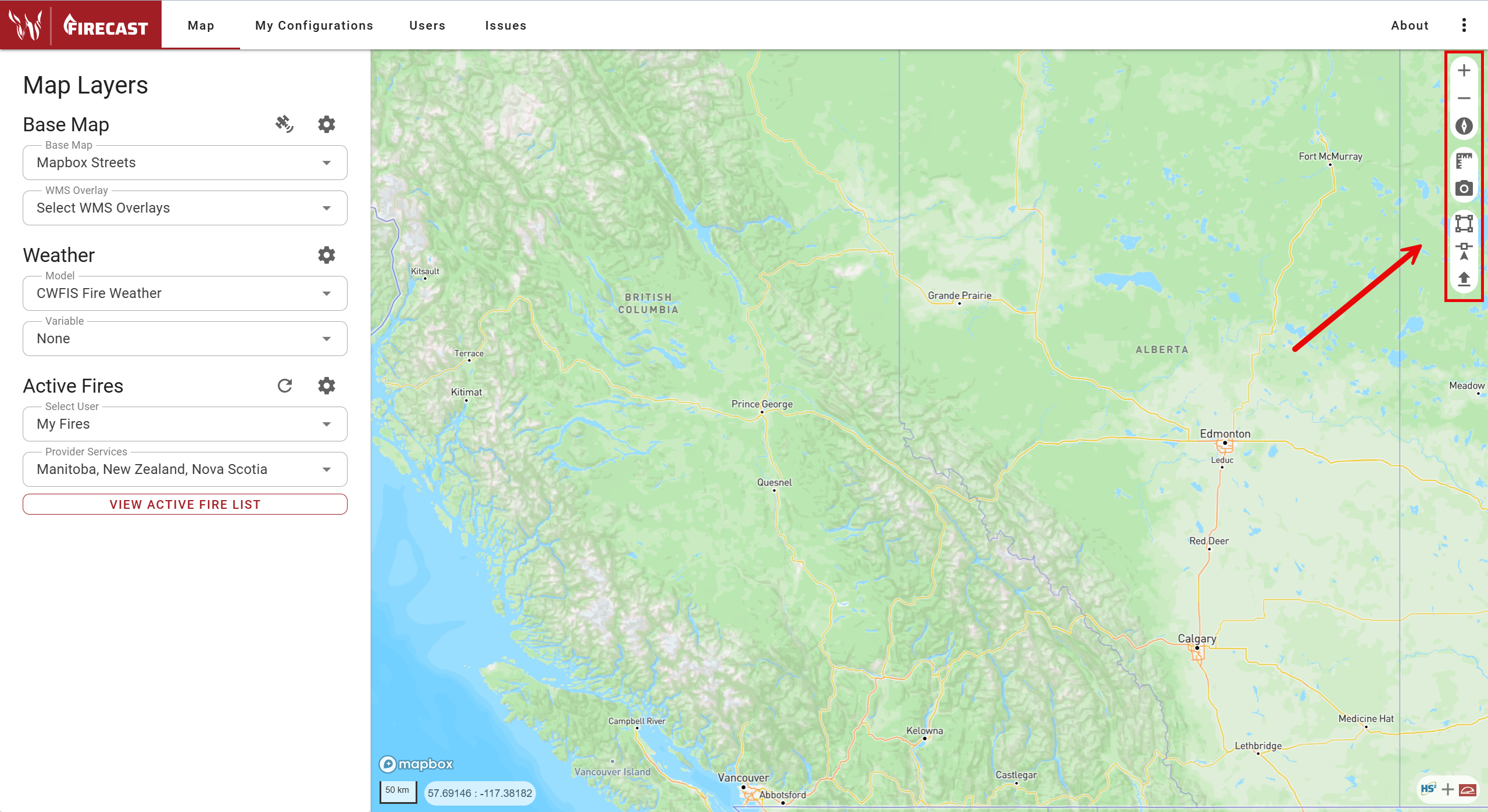
![]() Zoom in
Zoom in
![]() Zoom out
Zoom out
![]() Reset to north
Reset to north
![]() Measure (click once on the map to start the measure tool. As you click on the map, the tool will keep an accumulated count. Click
Measure (click once on the map to start the measure tool. As you click on the map, the tool will keep an accumulated count. Click ![]() once more to dismiss the tool).
once more to dismiss the tool).
![]() Screenshot (a screen capture of the map will be downloaded onto your computer’s files).
Screenshot (a screen capture of the map will be downloaded onto your computer’s files).
![]() Create polygon ignition (interactive with the map display).
Create polygon ignition (interactive with the map display).
![]() Create point ignition (interactive with the map display).
Create point ignition (interactive with the map display).
![]() Load a GeoJSON file (import a perimeter).
Load a GeoJSON file (import a perimeter).
Note: the tools create point and polygon ignition, and load a GeoJSON file require permissions on your account.