
Map Overview
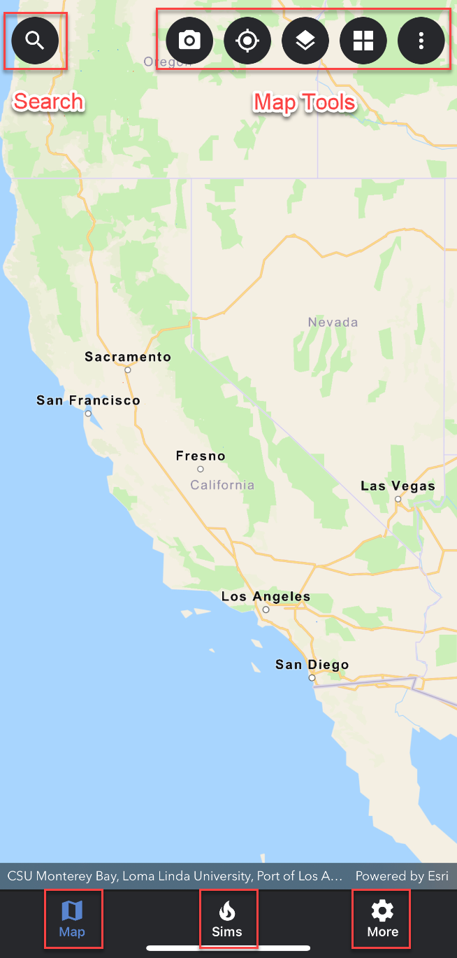
The WFA Mobile user interface is divided into 3 distinct tabs: Map, Sims, and More. Use the map tools to create, view and control simulations, as well as, select ALERTWildfire cameras and IRWIN incidents. Use the search tool to search for a specific latitude and longitude as well as search for a previously created simulation.
The simulations tab is where you can select previously run simulations. Under the more tab is where you will find access to the application’s settings menu. The settings menu is where you can set default values for simulation duration and simulation size. You can also quickly log out in the more menu.