
April 2023
What’s New?
The new layout allows you to pull the map to full screen, or make the Asset List full screen. You can also hide the Asset List entirely.
The new layout on the left-hand side allows for potential new features such as dashboards, summaries, and more. For now, this new layout shows the original Asset List and Asset Details views, as well as the new Territory Details risk metrics:
When viewing territory layers on the map, you can click anywhere within the domain boundary to view details of the Territory Risk metrics. You can either navigate to the left-hand tab to select this new feature, or you can click “View Details” from the pop-up window when you select any point on the map. Use this new Territory Details tab to view details for any of the territory metrics: risk, weather, and fuels throughout your service territory.
While this feature is enabled, you can also click any other map icons like cameras and weather stations.
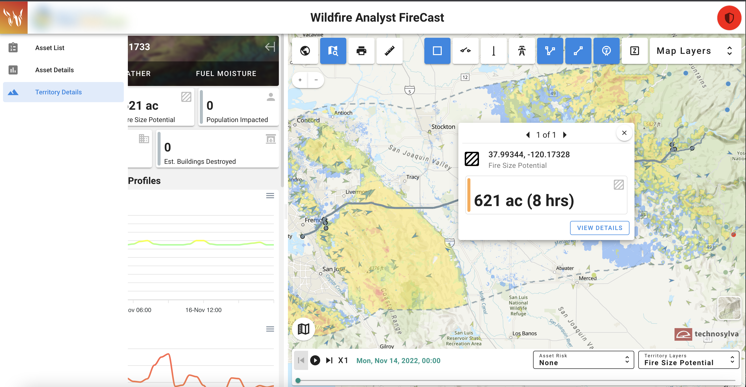
While making these layout adjustments, we identified a more straightforward way to get to the Asset Details page. Now you can simply click on any asset name within the Asset List to navigate to the associated Asset Details page.
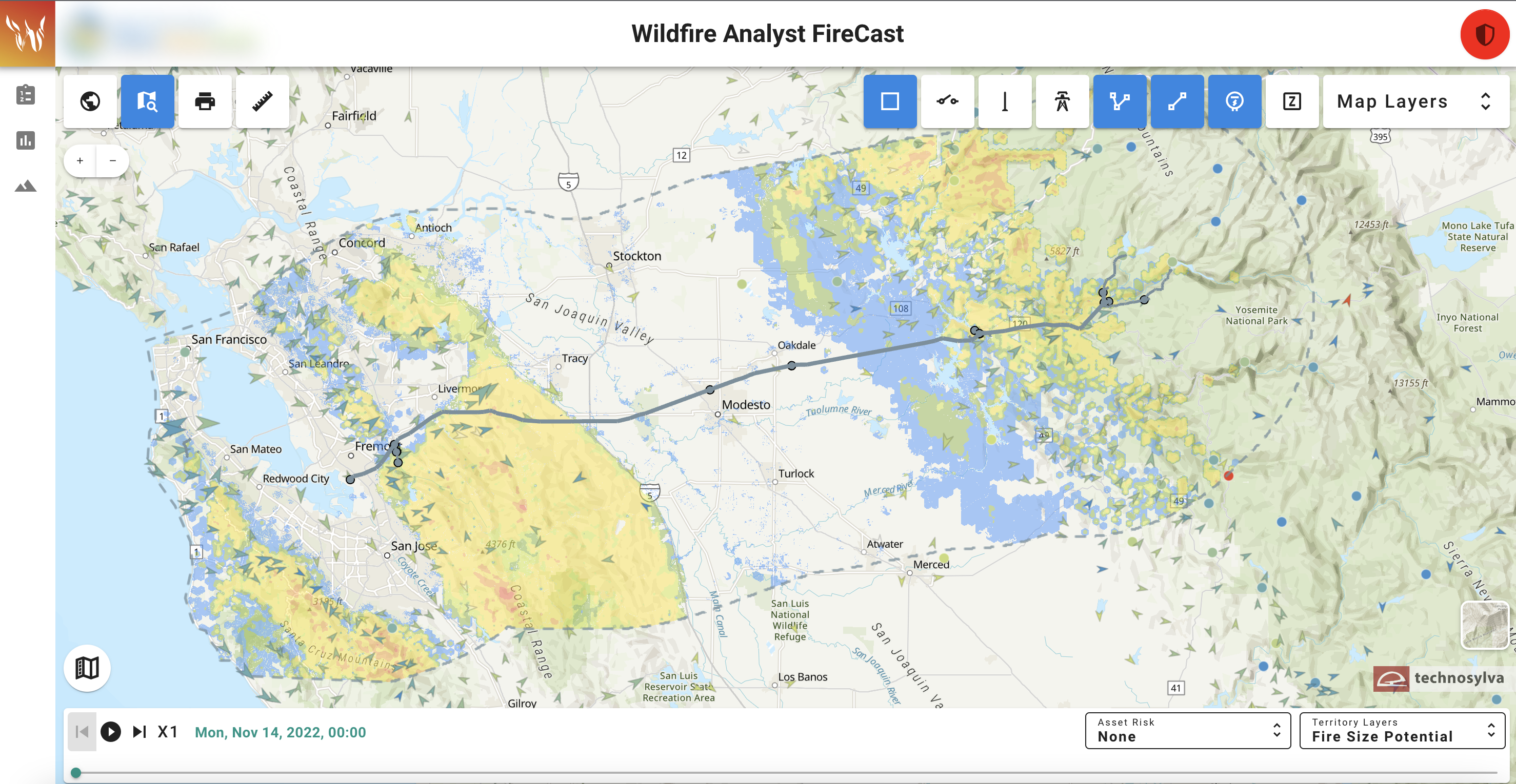
Updates to the Map Reference Layers:
Added utility-specific devices as a reference layer (field reclosers and switches).
PG&E Fire Index Areas added as a map reference layer.
Updated weather station layer source from synoptic to include utility weather stations.
The size of the arrows reflects the magnitude of the wind speed, they point in the direction the wind is flowing, and they are colored by temperature.
Stations that do not have wind data are displayed as a circle and are also colored by temperature.
The Layers previously titled Burning Index (BI) and Energy Release Component (ERC) have been updated to align with new terminology from the source: https://m.wfas.net/dev/wfas_sfwp_map_sacc.php
Burning Index → Fire Behavior Potential and Energy Release Component → Spatial Preparedness Level. The legend has also been updated for these layers to align with the data source, which has shifted from percentiles to levels.
We have updated these definitions in the Knowledge Base to reflect these updates.
Updated User Settings:
Under User Settings in the upper right-hand corner (the shield icon), more customizable features were added. In addition to the Blur feature and Asset Zoom Level, you’ll now see the the option to view “Just the map” or “Asset List”. Also in this menu, asset colors can be adjusted based on the users preference.
All of these customizable user settings should save when you refresh the app or logout and log back in.
What’s Coming: Items still in progress
Daily FPI by Zone summary/dashboard page
PSPS Tool
Known Bugs & Issues
When using the Print feature from the map, the weather station icons are not properly translating to the PDF. The team is aware of the issue and working on a solution.
It is important to note that the weather station layer currently does not filter out any suspicious data. The team is looking into including the “Quality Control” filter from synoptic so we could potentially hide or display differently any weather stations flagged "caution", and the pop-up card could also denote this flag.
In Territory Details under Fuels, the team has identified a bug in plotting the time series for Woody LFM. The line seems to randomly disappear upon a click, and re-appears upon another click. The team is investigating the cause of the issue within the graphing library the application is using.
The following Territory Risk layers are currently not displaying properly on the map: Fire Size Potential, Population Impacted, Buildings Threatened, and Estimated Buildings Destroyed. These risk metrics are still working as expected when viewing the Asset Risk layers and profiles, but not for the territory-wide risk. The team is actively working on resolving the issue and this will be the team’s priority the week of April 17, 2023.