
March 22, 2023 - v 2.3.3.8
New Features!
1. Improved application launch time
2. Added Extended Attack Metrics in the Risk Forecast Tool
H3 hexagon-based metrics include:
i. Extended Attack Assessment
ii. Evaporative Demand Drought Index
iii. Fuel Complexity
iv. Lifted Index
v. Convective Flag
vi. Terrain Difficulty Index
vii. Vapor Pressure Deficit
viii. Wind Speed
3. Added a custom weather tool to FireSim
4. Added a new Map Report for simulations
5. San Diego Unit code renamed from MVU to SDU
6. Fixed the Alert Camera network to show both AlertWildfire and AlertCalifornia cameras
Main Tools
7. Risk Forecast
a. Changed “Metric” to Initial Attack Metrics
b. Added, renamed, and re-ordered Initial Attack Metrics
New Name | Old Name |
Fire Size Potential (ac) | Fire Size Potential |
Population Impacted | Population Impacted |
Buildings Threatened | Buildings Impacted |
Estimated Buildings Destroyed | NEW! |
Fire Behavior Index | Fire Behavior Index |
Initial Attack Assessment | NEW! |
Response Complexity | NEW! |
Rate Of Spread (ch/h) | Rate Of Spread |
Flame Length (ft) | Flame Length |
c. Added Extended Attack Metrics as H3 hexagon-based metrics
i. Extended Attack Assessment
ii. Evaporative Demand Drought Index
iii. Fuel Complexity
iv. Lifted Index
v. Convective Flag
vi. Terrain Difficulty Index
vii. Vapor Pressure Deficit
viii. Wind Speed
8. FireSim
a. Under Adjust Data, added ability to use a Custom Weather File for simulations. This allows users to change multiple weather inputs by hour
b. Added a new report type: Map Report
i. This is a one-page report with a large map and any buildings or transmission lines impacted by the simulation
9. FireRisk Identify
a. Added Risk Values: Response Complexity and Initial Attack Assessment
b. Added tab for Extended Attack Metrics
Integration Tools

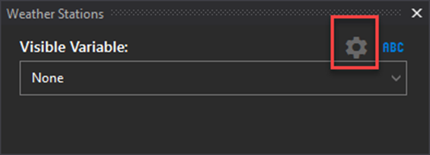
10. Weather Stations
Added a shortcut to Weather Settings
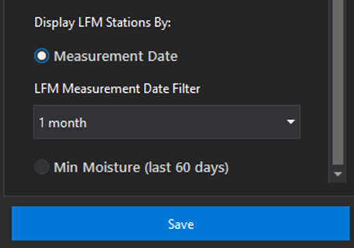
11. LFM Stations
LFM Stations can be displayed by minimum moisture readings. Only stations with readings in the last 60 days are displayed. To symbolize stations by moisture readings, go to Settings > Weather Defaults and scroll to the bottom.
Navigation Tools & Miscellaneous Tools

12. Added a Fuel Calculator Tool
This is a permissions-based fuel calculator tool intended to provide FBANs information on the behavior of fuels with charts and graphs
Settings
13. Added ability to change GPS Tracking 3D model size
14. Added ability to enable an enhanced trace log to help trace connectivity issues
Bug Fixes
15. Resolved credentials bug for Aerial Intel Heat Point
16. Fixed bug when importing KMZ files for the Measurement and Impact Tool
17. Improved performance when using the WindNinja option for simulations
18. Fixed bug that caused the application to crash when searching for an incident in the FireSim tool
19. Fixed the Alert Camera network issue
20. Updated error messages and spelling throughout