
Territory Risk, Weather & Fuel Moisture Layers
Territory Risk (risk, weather, and fuel moisture) pertain to the risk that is for your service territory. Unlike asset risk, territory risk is produced across your entire service territory using a grid of ignition points rather than asset locations. This provides additional risk information that allows you to view the risk, weather, and fuel moisture for locations and areas across your service territory.
Any of these territory layers can be queried. Learn more about querying the map here.
Territory Risk

Fire Size Potential territory risk selected and being displayed for the service territory on the map.
Risk metrics are available territory-wide, and based on eight hour unsuppressed fire spread simulations. Note: not all risk metrics will be available in your version.
Territory risk can be viewed on the map. Territory risk is calculated at 3-hour intervals across the entire forecast for the entire service territory. Risk be viewed for each of these time intervals of the forecast across the territory. This provides you with a visual representation of territory risk on the map showing which areas are the highest risk at a given interval in the risk forecast.
Weather
The primary weather forecast data is provided daily from the Weather Research and Forecasting (WRF) model’s advanced weather prediction system. WRF is a state of the art mesoscale numerical weather prediction system designed for both atmospheric research and operational forecasting applications. In FireRisk Web, WRF outputs are updated daily at a 2km spatial resolution for the entire service territory, for a 100-hour forecast horizon (roughly 4-day outlook).
Note: Not all customers have subscribed to the high-resolution WRF data.

Wind speed selected and displayed across the service territory.
The weather variables forecasted for your service territory include:
Temperature
Wind Speed
Relative Humidity
Fuel Moisture
Fuel moisture is a measure of the amount of water in a fuel (vegetation) available to a fire, and is expressed as a percent of the dry weight of that specific fuel. Stated generally by NCEI NOAA, “When fuel moisture content is high, fires do not ignite readily, or at all, because heat energy has to be used to evaporate and drive water from the plant before it can burn. When the fuel moisture content is low, fires start easily and will spread rapidly - all of the heat energy goes directly into the burning flame itself.”
Technosylva fuel moisture calculations utilize the Weather Research and Forecasting (WRF) model as input to the Nelson dead fuel moisture model, which is widely accepted across the fire behavior modeling community. The dead fuel moisture results have 2km spatial resolution and the resulting classifications represent the time lag it takes for a fuel’s moisture content to reach equilibrium with its environment.

Fuel Moisture 10h selected and displayed for the service territory.
The dead fuels forecasted for your service territory include:
Moisture 1hr or 1-hr Fuel Moisture: 1-hr fuels are the fine dead fuels, with diameters less than 0.25”, such as grasses. The moisture contents of 1-hr fuels respond quickly (within minutes) to changing weather conditions.
Moisture 10hr or 10-hr Fuel Moisture: 10-hr fuels are small dead fuels, with diameters ranging from 0.25” to 1”. The moisture contents of 10-hr fuels respond quickly to changing weather conditions, but not as quickly as the 1-hr fuels.
Moisture 100hr or 100-hr Fuel Moisture: 100-hr fuels are standard dead fuels, with diameters ranging from 1” to 3”. Due to the larger size, the moisture content of 100-hr fuels respond slower to changing weather conditions. 100-hr fuels can be used to estimate the average moisture content of the forest floor.
The live fuel moisture products are derived from a machine learning model that ingests satellite observations and in-situ observations. The metrics are updated weekly for your service territory including
Woody LFM - Woody Live Fuel Moisture (shrubs and trees)
Herbaceous LFM - Herbaceous Live Fuel Moisture (primarily grasses)
Live fuel moistures differ from herbaceous fuels and woody fuels, primarily due to phenological differences. To understand how to use these percentages, NWCG defines the flammability range extends from about 35 percent to well over 200 percent in living vegetation, and about 1.5 to 30 percent for dead fuels. Learn more about these fuel definitions at NWCG.
Soil moisture for fire extinction is generally considered 15%. At 15% soil moisture content, there is likely no fire spread.
Note: Not all customers have subscribed to the high-resolution fuels data.
Selecting a Territory Metric
You can select which territory metric you want to view on the map for your assets in the timeline control.
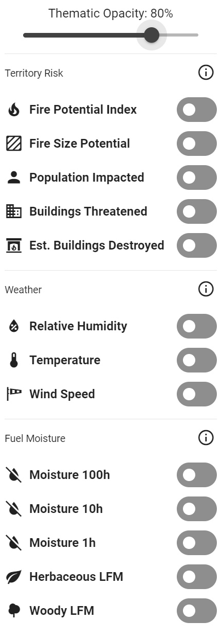
Territory layers selector.
To select a territory metric/layer:
Click on the Territory Layer dropdown to open the territory risk layers in the timeline control.
Toggle on the metric you want to view.
The selected territory metric will now be displayed on the map. You can now use the timeline control to cycle through the selected territory forecast.
Only one territory risk metric can be displayed on the map at a time. However, you can view a territory risk metric at the same time as an asset risk metric. Note: not all risk metrics will be available in your version.
Adjust Territory Layer Transparency
To adjust the transparency of a select territory layer:
Click on the Territory Layer dropdown to open the territory risk layers in the timeline control.
At the top of the pop-up, the is a transparency slider. Use the slider to adjust the transparency as needed.